
Last Updated on February 14, 2013 6:15 pm
The month of January was certainly full of weather extremes in a short amount of time. Snow, wind and floods became the main issues to begin the new year.
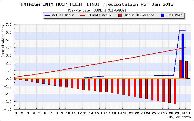
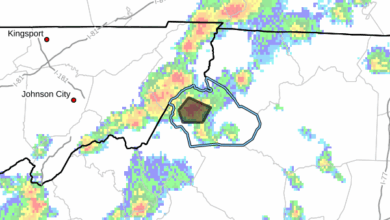
Flooding on January 30 not only became a significant history event for Watauga County, as the first ever Flash Flood Emergency was issued, but capped off a 15 day span of nearly everything Mother Nature could toss our way.
Heavy rains across the area caused flooding problems in Watauga, Ashe and Johnson County TN. On January 15 heavy rains caused major flooding in Ashe and Johnson County TN. Following the heavy rains the area was hit by snow. Winter Storm Warnings, Advisories and Watches were issued across the region.
Wintry conditions continued into January 17 as the rain turned to all snow, leading to early dismissal of schools. Late in the afternoon heavy wet snow began falling causing roads to become slick quickly. Power outages were a problem with 8,000 Blue Ridge Electric members in the dark, mostly in Ashe County.
Here's a recap of snow across the region on January 17 from the National Weather Service.
Road conditions improved on January 18 but power outages were still a big problem. It took until Saturday Jan 19 for power to be completed restored across the High Country. Here's a look at some of the pictures that came in on January 19.
The regional snow depth provides a great look at how much snow fell from January 17- 23.
Very cold conditions forced local schools to delay or cancel classes. Wind chill readings in the single digits and below were felt the week of January 21-25. Peak wind gusts above 60mph were also recorded.
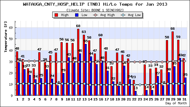
From the Watauga Medical Center reporting station:
High – 68.18 – Saturday Jan 12
Low – 13.46 Tuesday Jan 22
Peak Wind gusts – 66mph Thursday Jan 24 at 6:15am
Graphics provided by http://mesonet.agron.iastate.edu