
Last Updated on October 2, 2022 5:40 pm
*Updated continually as information comes in*
Monday Jan 21
3:30pm – temps haven't dropped all the much this afternoon but the winds have picked up making it feel MUCH colder. Peak gusts so far in Boone is 33mph at 2:55pm.
4:40pm – ACCIDENT – on 105 near New River Building Supply, expect delays
4:45pm update – ACCIDENT – on 105 near New River Building Supply, truck on its side. Delays in the area.
For Tuesday Jan 22
Watauga County Schools are on a 2 hour delay for Tuesday. Buses will travel paved roads only.
Avery County Schools will be operating on a 2 hour delay for students on Tuesday, January 22
Johnson County Schools will be on a 2 hour delay on Tuesday, January 22nd
Tuesday Jan 22
21 degrees with a wind chill of 9 in Boone at 1:30am
19 degrees with a wind chill of 1 above in Boone at 2:40am
16 degrees with a wind chill of 0 in Boone at 5:15am. Peak gusts so far of 44mph.
15 degrees with a wind chill of -2 in Boone at 6:10am, Wind chill so far of -28 on Grandfather Mtn
8:20am – 13 degrees in Boone with wind chill of -6. peak gusts so far of 44mph at 3:35am
1:22pm – Sunny but continued cold, as it will be this week. Forecast wind chill values: today 4 below, tonight 3 below, Wednesday 7 below, Wed night 2 above, Thursday 3 above.
Wednesday Jan 23
Lane closures on 321 today in Blowing Rock at Elk Ridge Lane & at Cliff Dwellers
Per DOT – “NCDOT will pretreat 4-lane roads in Surry, Wilkes, Yadkin counties Thursday mid-morning, others as time permits. Mtn. roads OK.”
3:30pm – overturned vehicle at bottom of Friendship Church Road may cause some delays in that area.
4:05pm – twitter report of truck overturned on Bamboo road and 421 at gas station
4:07pm – per scanner a lumber truck is on its side on 421 and Bamboo Road, reports are there's a lot of lumber in the road.
Photo by Ashley Keller

Thursday Jan 24
High Wind Warning in effect til noon
5:50am- power outages Watauga 338, Ashe 59, Wilkes 11
Tree down on 1200 block Lonnie Carlton Rd and the 6100 block of Elk Creek Rd. BREMCO and Stewart Simmons fire on scene Elk Creek Rd.
Peak wind gusts of 62mph in Boone at 5:35am
Peak wind gusts of 66mph in Boone at 6:15am
7:15am – Caution, roof from a shed in the roadway Brown's Chapel Rd near the top.
8:11am- power outages Watauga 303, Ashe 70,, Caldwell 15, Avery 6, Wilkes 2, Alleghany 1 – Blue Ridge Elect service area
8:17am – wind gusts of 60, 62, 66, & 63mph all in a 3 hour span this morning in Boone. Lots of 50mph plus as well in that span.
9:15am- power outages Watauga 91, Ashe 33, Caldwell 52, Avery 139, Wilkes 3 – Blue Ridge Elect service area
9:20am – Grandfather Mtn reports 3-second gust of 109mph in 7am hr. Highest gusts last 3 hrs & all top gusts over 80 mph in the last 9 hours.
Video briefing from NWS
9:26am – DOT reports No road closures on 321 in Blowing Rock today. Possible lane closures today.
Marie Weaver passed along this picture she took during the snow

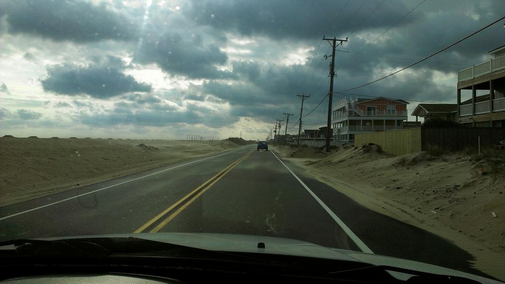
Not quite as windy as us but still 30mph plus gusts on Outer Banks blowing sand around. Photo: Sam Walker
9:55am – DOT reports that crews applying salt brine to primary rds in Surry, Wilkes, Yadkin, Caldwell counties
10:30am power outages – Watauga 11, Ashe 36, Caldwell 6, Avery 1, Wilkes 2 – Blue Ridge Elect service area
12noon – power outages – Watauga 41, Ashe 1,Avery 13 – Blue Ridge Elect service area
NCDOT Crews Statewide Preparing Roads for Winter Weather – see story here
12:45pm power outages – Watauga 39, Ashe 1
12:45pm – wind gusts have died down some but still gusting into the 20s and 30s
We do have the chance for sleet/freezing rain, along with snow, for Friday (check the forecast here). This could pose travel problems. Also if your travel plans take you out of the High Country be sure to check the forecast for that area. Ice is expected to our west, south, and east.
Winter Weather Advisory for Johnson County, TN from 7am Friday to 7pm Friday.
Winter Storm Watch for Johnson County, TN from 1am Friday morning to 7pm
Winter Weather Advisory from 1/25/2013 6:00 AM to 11:00 PM EST for Avery County, Caldwell County. http://1.usa.gov/W33LmG
Every county in the immediate area will be under a Winter Weather Advisory starting early Friday and lasting through Friday night.