Last Updated on October 2, 2022 5:46 pm
Snow and very high winds are forecast for the High Country starting on Thursday night. Winds of up to 60mph are possible Thursday night – Friday night. Snowfall is forecast to start late Thursday night. Below is information from several weather sources about the upcoming storm.
Thursday Dec 20 National Weather Service video update
Brad Panovich ,WCNC NewsChannel 36 Chief Meteorologist, video update
——————————————————————————————————————-
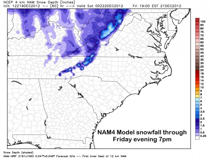
Wednesday Dec 19:
Brad Panovich ,WCNC NewsChannel 36 Chief Meteorologist, passed along via facebook this graphic and information.
“Some really decent snows for the mountains staring late Thursday night and lasting into Saturday. Right now my early thoughts are 2-4″ with highs amounts around 6″ at the highest elevations near the TN line.”
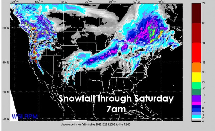
He also passed along the national snow fall forecast map through Saturday morning at 7am.
The National Weather Service came out with their video summary on Wednesday afternoon.
John L'Heureux of L'Heureux's Weather (http://www.facebook.com/LHeureuxs.Weather) passes along “Encouraging signature and I concur. Most of the High Country will see 1-3″ of snowfall Friday/Saturday, with isolated areas getting up to 4″. App Ski Mountain will fall at about 1″; Sugar Mountain will be in the 2-3″ category and Beech Mountain will be between 3-4″. I apologize in advance for people along/east of the Blue Ridge Parkway, as snow totals will be at just a dusting.”
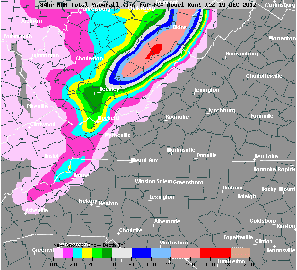
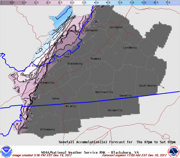
National Weather Service graphics

The National Weather Service forecast calls for:
Thursday: Mostly cloudy. Rain showers…mainly in the afternoon. Breezy with highs in the upper 40s. South winds 20 to 25 mph with gusts up to 40 mph. Chance of rain 90 percent.
Thursday Night: Mostly cloudy. Rain showers likely with a chance of snow showers in the evening…then a chance of snow showers after midnight. Snow accumulation up to 1 inch possible. Windy and cooler with lows in the lower 20s. Southwest winds 25 to 30 mph with gusts up to 50 mph…becoming west 20 to 30 mph with gusts up to 60 mph after midnight. Chance of precipitation 70 percent. Wind chill values as low as 8 above.
Friday: Mostly cloudy with a 50 percent chance of snow showers. Light snow accumulation possible. Very windy and much cooler with highs in the lower 30s. West winds 25 to 35 mph with gusts up to 65 mph. Wind chill values as low as zero.
Friday Night: Mostly cloudy with a chance of snow showers in the evening…then partly cloudy after midnight. Little or no additional snow accumulation. Very windy and cold with lows around 20. Northwest winds 30 to 40 mph with gusts up to 70 mph. Chance of snow 50 percent. Wind chill values as low as zero.
Saturday And Saturday Night: Mostly clear and very windy. Highs in the mid 30s. Lows in the lower 20s. Wind chill values as low as zero.
Sunday And Sunday Night: Partly cloudy. Highs in the lower 40s. Lows in the mid 20s.