High Country Tornado Data

High Country Tornado Data
Comprehensive tornado history and statistics for the High Country region of North Carolina
🔄 Last updated: Thursday, September 26, 2024
📊 Data researched and compiled by Kenneth Reece
Did You Know?
Tornadoes are not frequent in the High Country, but you may be surprised at the number of watches and warnings issued over the years. Our mountainous terrain and elevation provide some natural protection, but we're not immune to severe weather.
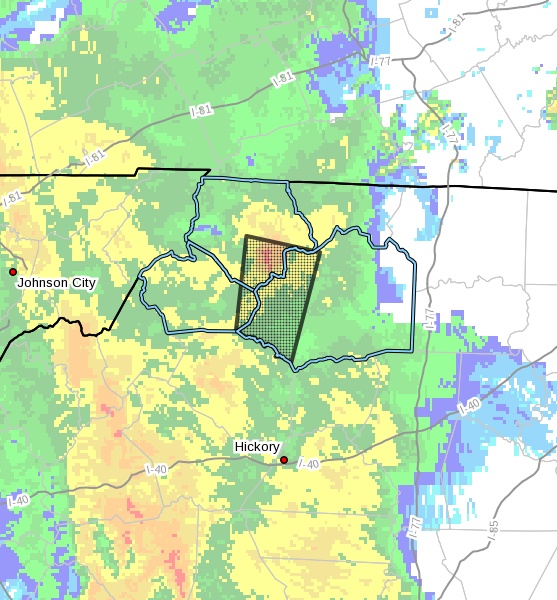
Historic First Warning
Sunday, October 8, 2017, at 6:29 PM – The first ever Tornado Warning was issued for Watauga County, specifically for Southeastern Watauga County. This marked a significant moment in local weather history.
Recent Activity
Latest Tornado Watches
- Monday, August 7, 2023 – Most recent Tornado Watch issued for the High Country
- Monday, October 23, 2017
- Wednesday, May 24, 2017
- October 14, 2014
- Sunday, July 27, 2014
Latest Tornado Warnings
- Wednesday, September 25, 2024 – Tornado Warning issued for Watauga County during the evening
- Monday, August 14 & Tuesday, August 15, 2023 – A series of Warnings issued for Watauga, Ashe, and Avery counties
- Saturday, July 15, 2023 – Warning for Ashe & Alleghany counties
Confirmed Tornado History
Location: Blowing Rock, Watauga County
The tornado touched down near the intersection of Birch Drive and Hill Street and traveled northeast before lifting. Several softwood and hardwood trees were uprooted and snapped along the path, and a few free standing tents near Bass Lake Drive and Chetola Lake Drive were blown down.
Read Full Report →Location: Western Watauga County
EF1 tornado moved a short distance into western Watauga County before lifting. Sporadic uprooted trees were noted in a wooded area between Buckeye Road and Seminole Trail.
Read Full Report →Location: Flat Springs community, Northern Avery County
The tornado tracked through the Flat Springs community shortly after midnight. Tree damage was observed along Dark Ridge, Joe Parlier, Beech Mountain, Buckeye, and Buckeye Lake Roads.
Read Full Report →Location: Wilkes and Ashe Counties
The tornado touched down as an EF1 near Highway 421 close to Harley in Wilkes County and traveled close to 7 miles north to Idlewild in southern Ashe County. Most damage consisted of snapped trees, with half a dozen structures suffering minor damage, mainly along Summit Road, just south of the Blue Ridge Parkway in northwest Wilkes County. The tornado crossed the Blue Ridge Parkway just southwest of Elderberry Lane then crossed Phillips Gap road, downing large pine trees.
Location: Zionville, Watauga County
3-inch hail was reported along with the high winds. Large trees were reported down in Meat Camp and trees and tree limbs lead to power outages from 3.5 miles west of Zionville to 1 mile south of Todd. A few barns were destroyed. Numerous trees were toppled throughout Wilkes County too, knocking down some power lines with 3,300 people losing power.
Location: Tweetsie Railroad parking lot, Watauga County
Notable incident: One of the 2 injuries reported was a man that suffered a broken rib after being lifted into the air by the tornado and then dropped. 16 vehicles were damaged.
Location: Avery County
This was the strongest tornado recorded in the immediate High Country area, classified as an F2 on the Fujita scale.
County-by-County Statistics
Tornado Watches and Warnings from January 1, 1986, until April 13, 2024:
Neighboring Counties
- 📍 Wilkes County: 8 recorded tornadoes (most recent: Thursday, April 11, 2024)
- 📍 Caldwell County: 10 recorded tornadoes (most recent: Sunday, October 8, 2017 – two warned storms that day)
Video Coverage
Watch coverage and footage from High Country tornado events and severe weather.
Tornado Coverage Title
Description of video content will go here.
Severe Weather Update
Description of video content will go here.
Damage Assessment Footage
Description of video content will go here.
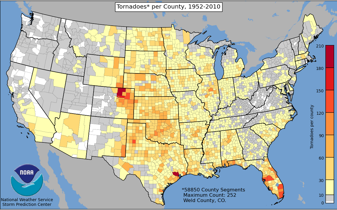
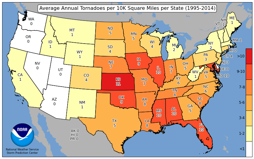
Historical Tornado Map
The National Weather Service Storm Prediction Center compiled a map of tornadoes by county from 1952-2010. Watauga, Avery, Wilkes and the neighboring Tennessee counties are in the 10 and under category, while Ashe County had 0 recorded tornadoes during this period.

Map source: ustornadoes.com
Understanding the Data
The map shows tornado frequency by county. Our High Country counties benefit from mountainous terrain and higher elevation, which generally provides some protection from tornado formation. However, as this historical data shows, tornadoes can and do occur in our region.
Graphic & radar image showing first issued Tornado Warning for Watauga County.