
Last Updated on December 21, 2012 4:56 am
*A running and updated list of conditions across the High Country*
4:38am – Overnight snow fell across the area, as winds picked up and some power outages were reported. “Winds picked up in Blowing Rock at the ten o clock hour” Greg reported on the facebook page. Karen posted that power went out at about 2am in Foscoe near Grandfather Mountain Campground, and was out for almost an hour.
A little earlier at 9:53pm on Thursday night Molly posted that “Snowing/sleeting on Junaluska Rd….sure is coming down and sticking too! Deck is covered within 5 minutes!”
Several overnight power outages left area residents in the dark. A twitter report that came in from around 3am “Power outages increasing in mountains and 39% of peeps in Avery County have no power. Much along watauga/Avery line”
As of 4:53am there were 273 Blue Ridge Electric customers without power in Ashe County, 64 in Watauga, 10 in Avery.
Wind are continued to gusts up to 65 mph for most of the area today, with the higher gust starting this afternoon. So far as of 4:55am the peak gust at Watauga Medical Center's reporting station was 61 mph at 3:15am, followed by gust of 58 at 3:55am and 52 at 1:35am.
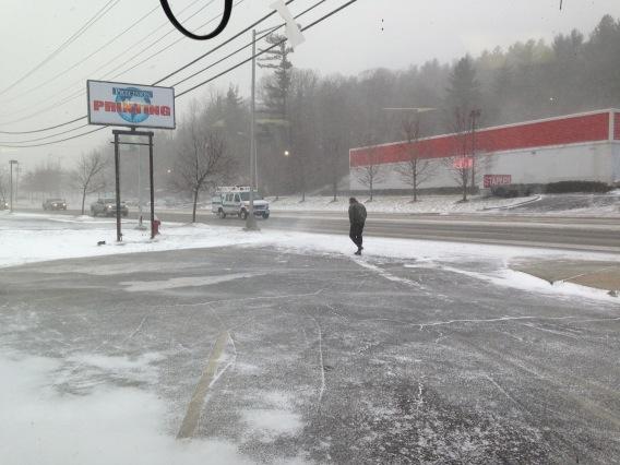
The area did get some snowfall, mostly an inch or maybe a little a more. Roads at this time are not a problem, at least per any reports coming into facebook and twitter as of 5am.
5:18am – power outages: 273 Ashe, 10 Avery, 1 Watauga
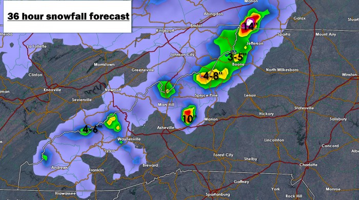
5:25am – Here's two maps from Brad Panovich about what to expect regarding snowfall for the High Country. The maps are for 36 hours from just before midnight on Thursday night. Click on them for a larger view.

5:34am – twitter report “Report from 4000′ NW Watauga Co. Temp = 24 degs, 1/4 inch of snow and power went out 3 times through the night.”
5:47am – Johnson County TN schools are closed today. Watauga schools are already out for the holidays.
5:53am – power outages: 273 Ashe, 10 Avery, 11 Watauga
6:04am – power outages: Ashe 43, Avery 10, Watauga 52
6:12am – Two Rivers Community School will be closed to staff and students
6:27am – scanner report of tree blocking the road on Chestnut Grove Road, and another on Howard's Creek Road.
6:31am – Per Watauga County Communications “Report that Howards Creek Rd has a tree across it at Jake miller Rd. Now another report of tree across Chestnut Grove Rd between 194 and Cobbs Creek Rd.”
6:36am – report coming in “Wilson's Ridge is a little slick. Use caution on the hill. Parts of Bamboo from 421 to WR also have snow. Tricky because roads go from clear to snow pack and back almost instantly and without warning.”
6:38am – report “Road sign in the road on 194 passed Jeffs Plumbing going towards Meat Camp”
6:42am – scanner report Howard's Creek at Jake Miller Rd is back open per tree down.
6:51am – power outages: Ashe 42, Avery 10, Watauga 1
6:55am – report “Roads on 194 up valley mountain are slick and covered”
6:57am via twitter to @wataugaroads “105 covered, front wheel drive light sedan made it up fine!”
6:58am report coming in “321 north and 421 from mnt city to boone slick in places”
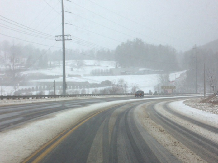
7am – You may find some slick spots but by and large roads are ok this morning so far. Couple reports of trees down in roads but DOT has taken care of those real quick. Winds continue to gust over 50mph and will pick up at the days goes along.
7:24am – might be slowing going on Blowing Rock Road at Shadowline intersection, scanner report of wreck with tractor-trailer and a vehicle.
7:28am – per Boone Police twitter feed – @boonepolice: Use caution in the area of Shadowline Dr/Blowing Rock Road minor wreck involving a tractor-trailer. Drive carefully and expect delays #boone
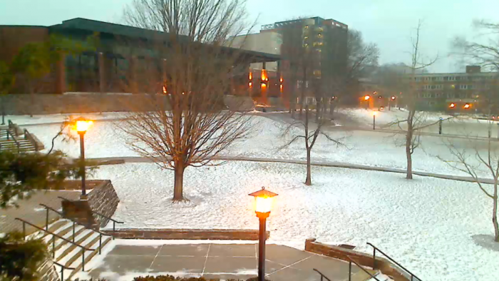
7:30am – Pic of the snow on the ASU campus from ASU Weather Cam facebook page
7:39am – power outages: Ashe 8, Avery 10, Watauga 21
7:51am – expect delays near 105 and Baird's Creek area, scanner report of a car in the creek.
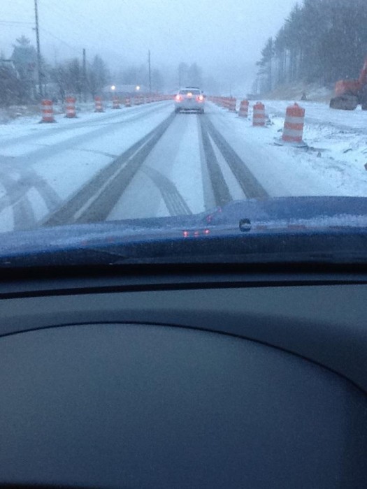
8am – per more reports coming in roads have gotten worse over the last hour. They are still passable but more snowfall and high winds are starting to impact more routes. Use caution.
8:06am – from Watauga County Communications emergency services are shutting down the roadway at 105S and Baird's Creek due to an accident on Baird's Creek. 8:20am UPDATE – EMS is shutting down Baird's Creek Road at 105 due to wreck. 105 in that area is open.
8:23am – getting report that 321 south of Blowing Rock is slick
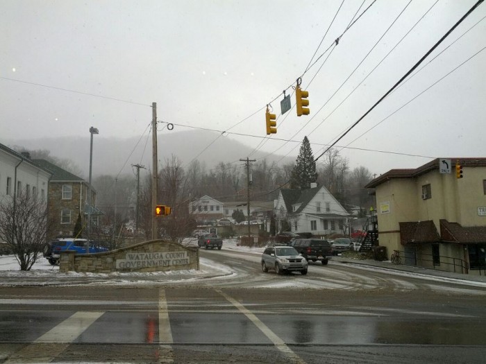
8:33am – The view in Western Watauga County from Deej Cornett

8:40am – winds continue to gust over 50mph this morning. Another gust of 52 mph at 7:15 in Boone.
8:49am – roads continue to be slick this morning, they have gotten worse since earlier this morning. Also still some scattered power outages: Ashe 19, Watauga 32
9:04am – From Watauga County Communications
US Hwy 321 S at Blackberry Condos reported to be very slick on in to Blowing Rock. A Caldwell county unit responding to stranded motorists near Green Park Inn had to turn around due to road conditions.
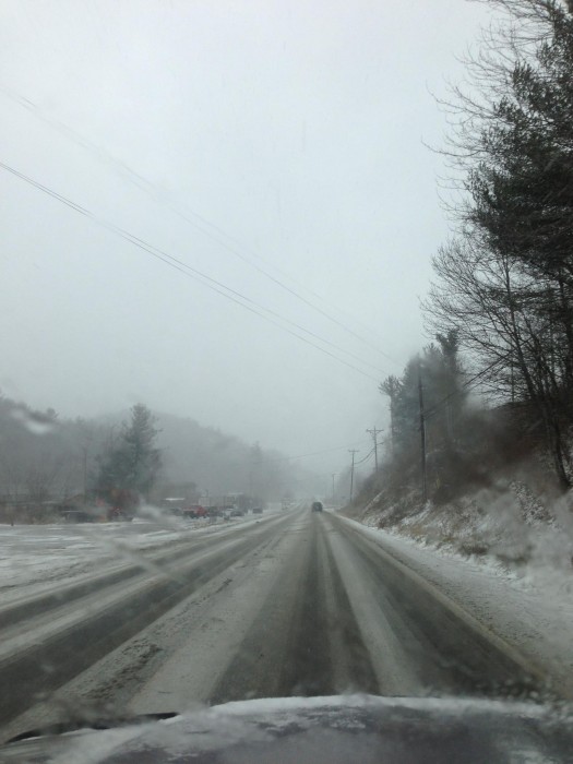
9:12am – Sent in via twitter, looks cold on 321 http://twitter.com/kmjordan3/status/282124438340780032/photo/1
9:12am – per scanner reports Niley Cook Road is a MESS. Two different wrecks on that road in two different places right now.
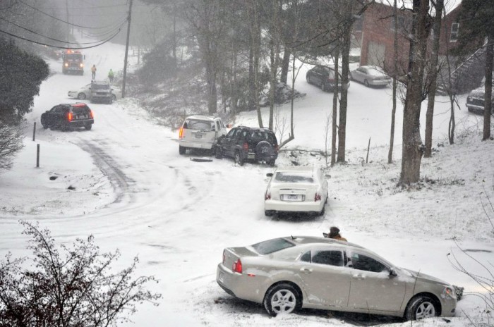
9:30am – roads are slick all across the area now. EMS officials are being dispatched to several more wrecks in Watauga right now. Use caution if you are out.
9:33am per Boone PD twitter feed – @boonepolice: Driving conditions are treacherous this morning. If at all possible stay at home. #boone
Niley Cook Road is a parking lot. Photo from Curly Stumb at 9:47am.
10am – wind readings from the reporting station at Watauga Medical Center (wind speed followed by gust speed):
9:35 AM NW 29G 45
9:15 AM WNW 14G 36
8:55 AM WNW 26G 43
8:35 AM WNW 31G 54
8:15 AM W 13G 30
10am – roads continue to be bad. EMS continue to be dispatched to wrecks and/or downed trees. Very strong wind gust and blowing snow continue and will all through the day. Use caution.
The view from Blowing Rock from Courtney Pearce at 10am
10:35am – tree blocking the road at 1618 Howard's Creek Road
10:45am – wind readings from the reporting station at Watauga Medical Center (wind speed followed by gust speed):
10:35 AM WNW 33G 51
10:15 AM W 20G 39
9:55 AM WNW 25G 52
11am – highway 321 at Tweetsie
11:12am – power outages are down to single digits for now – Ashe 7, Watauga 7. Strong gust continue most of the weekend. If your power goes out be sure to report it to Blue Ridge Electric Membership Corporation by calling 1-800-448-2383.
11:30am – the view in downtown Boone from Zach Seifts
12noon – the number of accident calls has decreased per scanner traffic. Area motorist are still advised to use caution as blowing snow and high winds will impact travel the rest of the day.
12:30pm – 105 bypass
1:03pm – Per Boone PD – We are having reports of several fender benders. The roadways are still snow covered please use caution & slow down if you are traveling.
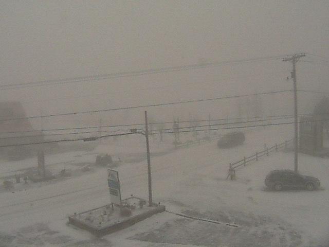
Beech Mtn today from Pam Croley
421 Intersect in Deep Gap 2pm

Wind blowing at Valle Crucis School at 12:30pm
Snow blowing across 105 at 12:35pp
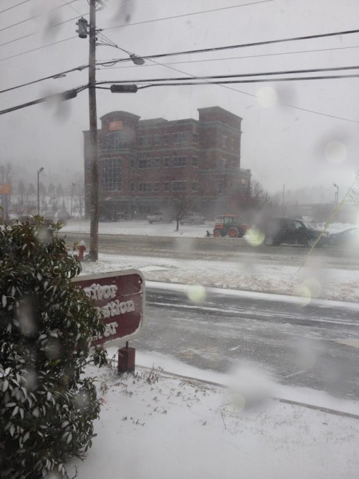
321 in front of the High Country Host Visitor's Center in Boone – 2:37pm
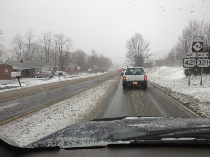
3:06pm – expect delays on 194 near DOT offices, wreck in the curve per scanner
Video from Fire Tower Road today by Bobby Cordell
3:15pm – 421/321 Boone Mountain
3:30pm – Most if not all roads are snow covered (some totally, some partly). EMS is starting to get more calls about wrecks now (just like this morning). If you have to travel allowed plenty of extra time and slow down. High winds and blowing snow will continue rest of today and tonight.
3:39pm – via twitter – the route from Mountain City, TN to Boone, NC is barely passable without a 4wd/awd! Roads are really slick!!!
4:03pm – wreck on 194 near DOT offices has been cleared
4:42pm – per DOT – No lane closures on 321 in Blowing Rock through Jan. 2, but you may see work being done.
5:15pm – High Wind Warning remains in effect until 6pm Saturday, Winter Weather Advisory is now in effect until 7am Saturday. Snow tampers off overnight but the high winds continue til Sunday.
5:15pm – use caution traveling tonight and through the overnight as the winds continue to gust over 50mph. Just like the 3:30pm update most if not all roads are snow covered (some totally, some partly).If you have to travel allowed plenty of extra time and slow down.
5:20pm – power outages: Ashe 55, Watauga 216
6:40pm – updates posted as may be needed if there are large power outages. Still scattered outages, also several reports to local fire departments of trees down mainly in the western end of the county. They are responding to those calls. Watch for slick roadways and continued high winds tonight.
8:26pm – an official peak wind gust of 70mph was recorded in Boone at 7:35pm. That was followed by gust of 60 and 59, all three within a 40min span
8:27pm – power outages: Ashe 101 , Watauga 278, Avery 1, Caldwell 1. Also getting report that power is out at Tynecastle in Banner Elk which is in the Mountain Electric service area.
8:31pm – scanner report of tree on a power line in the area of Popular Hill and Horseshoe in Boone. Power is reported out in that area.
8:44pm – if you are traveling into Avery, DOT has tweeted “Hwy 194 (Banner Elk Highway), South of Banner Elk Avery, Road Obstruction , Road Closed with Detour, at 12/21 8:39 PM”
8:48pm – if you are traveling tonight be EXTREMELY careful, the scanner is full of reports of trees down.
8:57pm – Foscoe Fire Dept dispatched to a tree down on Holloway Mtn Road reportedly blocking both lanes.
9:07pm – wind readings from the reporting station at Watauga Medical Center (wind speed followed by gust speed):
8:55 PM WNW 39G 62
8:35 PM NW 44G 61
8:15 PM NW 39G 59
7:55 PM NW 43G 60
7:35 PM WNW 38G 70
Official gust of 61 @ 8:35pm, 62 @ 8:55pm, 63 @ 9:15pm in Boone. That follows the 70mph at 7:35pm.
Max wind gust on Grandfather Mtn so far is 120mph as of 10pm. They may pass that overnight. 10:05pm a new peak gust of 121mph.
10pm – tree reported down on Ward's Branch Road blocking both lanes per scanner.
10:07pm – local fire depts continue to be dispatched to trees down across the roads and across power lines. USE CAUTION if you are gonna travel tonight and early tomorrow morning.
10:15pm – Blue Ridge Electric responding to the outages.
10:18pm – scanner report of tree down on State Farm Road in Boone, no power in that area.
10:29pm – report of tree down on Poplar Grove Rd at the church blocking traffic both ways. Also power is out in parts of Boone due to down tree on State Farm Rd.
10:32pm – tree reported down on 194 just past Mast Gap in Valle Crucis/Vilas. Blocking road
10:42pm – Power line reported down on Laurel Branch Rd per scanner.
10:45pm per a dispatcher with Boone PD “We are getting multiple calls at Boone Police Dept about downed trees and downed power lines. Roads are slick and snow covered, there are periods of near white out conditions due to the blowing snow and the wind chills are near zero. Please stay indoors and do not travel unless absolutely necessary. If you must travel, do so SLOWLY and CAUTIOUSLY. If you encounter a downed power line, do not approach it and NEVER attempt to drive over it. Please be safe out there tonight.”
10:51pm – Fire Depts and other EMS continue to respond to numerous trees down all across the county.